With the rapid development of technology in our modern world, GIS (geographic information system) has become very important. Professionals from different fields utilize GIS maps to aid in their decision-making. Once we understand what a GIS map is, the significance of GIS maps, and GIS data, we can eventually widen our horizons concerning the various ways in which geographical data can be used.
Understanding GIS Maps
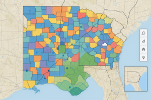
Let’s first understand “What is a GIS map?” GIS (Geographic Information System) maps are computerized maps of our world that connect data to a physical location. Not just visual representations, these maps come with additional information about particular places associated with the given map. Combining geography with data provides a living perspective on spatial relationships, revealing patterns and connections that might otherwise remain hidden.
Different Elements of Maps in GIS
A GIS map can have many components. A base layer provides visual context, typically of roads, topography, or administrative borders. Upon this foundational layer, various thematic data layers are placed on top of one another, each representing specific information. They could be detailed demographic statistics, defined catchment areas for resource management, real-time weather patterns and forecasts, and any other spatially referenced information. By default, each of the layers can be customized by the users. Users can tailor the map’s display and analysis according to their specific needs and objectives.
How GIS Maps Are Created
GIS maps are created by making use of data from multiple sources. The data pool often consists of satellite imagery, sensors, surveys, etc. We process and consolidate data using software once it has been gathered. The final product is an interactive map ready for analysis and interpretation.
The Advantages of GIS Maps
There are multiple benefits of GIS maps. A key advantage is that they can visualize complex data. Users can get an immediate sense of what patterns and trends exist without combing through spreadsheets. Moreover, maps allow real-time updates, keeping information up-to-date.
Use Cases in Different Domains
GIS technology is used in many sectors. For instance, urban planners utilize GIS maps to plan cities so that land space is not wasted. Farmers monitor the soil makeup and weather conditions in their area to maximize the amount of food they can grow. These maps assist emergency responders with disaster management and help allocate resources.
GIS in Business: Understanding the Concept
Businesses have also widely adopted GIS maps. Retailers look at customer demographics to determine where to place a store. Logistics companies chart their effective delivery routes, thereby reducing fuel consumption and improving service. These kinds of applications emphasize the generation of a cost advantage and operational strategic advantage.
Environmental Influence and Protection
GIS technology helps conservationists. They create ecosystem conservation plans by mapping habitats and monitoring wildlife movements. GIS maps are also used to track environmental changes, such as deforestation or changes in climate.
Beliefs in Education and Research
GIS maps are used for teaching purposes in educational institutes. Learners make sense of geography through interactive maps. In addition, GIS data is used for research related to urbanization, epidemiology, and more, with patterns revealed that may go otherwise unnoticed.
The Future of GIS Technology
The future of GIS technology is promising. The improvements in artificial intelligence and machine learning are likely to provide better information on map prediction and accurate maps. GIS maps are evolving with changing technology, and they will keep on finding new ways for us to use geography efficiently.
Why You Should Care
Understanding a GIS map is important for several reasons. They enable informed decision-making by both citizens and organizations. GIS technology delivered vital insights during the third quarter of 2020, whether in business, conservation, or elsewhere. At the same time, GIS maps provide tools for successful resource management, which will be necessary as challenges such as climate change grow.
Conclusion
GIS maps are a powerful combination of geographical information and data analysis. Their usefulness extends across numerous domains, revealing significant insights and resolutions. Their relevance makes it easy to understand how to better navigate the complexities of our world. Adopting GIS technology is the first step in keeping an eye on developing and rising challenges in the present and future.